

In early June, after vaccinations and a year of no traveling, my husband, Rick, and I hit the road and headed out West to visit the five big national parks in Utah—Canyonlands, Arches, Capitol Reef, Bryce Canyon and Zion. We also found some state park gems like Dead Horse Point near Moab and Snow Canyon near St. George. And we visited some amazing BLM locations like Anasazi Valley Petroglyph Trail and others where we hiked through colorful slot canyons—Little Wild Horse Canyon and Peek-a-Boo and Spooky Gulch. We added the North Rim of the Grand Canyon to the end of our trip, because why not?
Several friends have asked for our itinerary, and I’m happy to share. We started in Moab, Utah, and made our way down the state and into Arizona. We set a fast pace (nearly 70 miles of hiking over 10 days), because I like to see “everything.”
I’ll organize this trip by area, and you decide how many days to spend in each place.
Here’s how to do what we did:
Moab—Canyonlands National Park, Arches National Park and Dead Horse Point State Park with a side trip to Little Wild Horse Canyon
Canyonlands is huge! There are four districts—Island in the Sky (most popular), The Needles, The Maze and The Rivers. The Maze is the least accessible unless you have a four-wheel-drive, high-clearance vehicle (and are fully prepared for self-sufficiency). Next time we visit, we will hire a guide and a big vehicle to see the ancient, life-size pictographs (painted figures) and petroglyphs (figures etched in stone) in Horseshoe Canyon in the Maze district; this is some of the most significant rock art in North America.

On our visit this summer, we hiked the Island in the Sky district. We started with an easy, short walk to Mesa Arch, then hiked about 2 miles round trip to view the impressive Upheaval Dome (the crater is 3 miles wide and more than 1,000 feet deep and there are conflicting views about why it’s there) and finally, we hiked 2 miles out and back along the mesa’s edge to the Grand View Point Overlook (with amazing views the entire time). We arrived around 9 a.m. and spent an entire day at Canyonlands.
Arches is busy! Go early. Like 6 a.m. early. They were shutting down the entry gate mid-morning and again mid-afternoon, and it’s always busy until they do. So go early, take your breakfast, take your lunch, take your snacks and extra water and make a day of it.

We started with a three-mile out-and-back hike to Delicate Arch where we had a breakfast Clif Bar and then waited in a very civilized and organized line to have our photo taken under the arch. The way it works, everyone takes a turn, and you can get a good photo of the arch (with no people!) as one group leaves and the next comes up. Timing is everything at Arches!

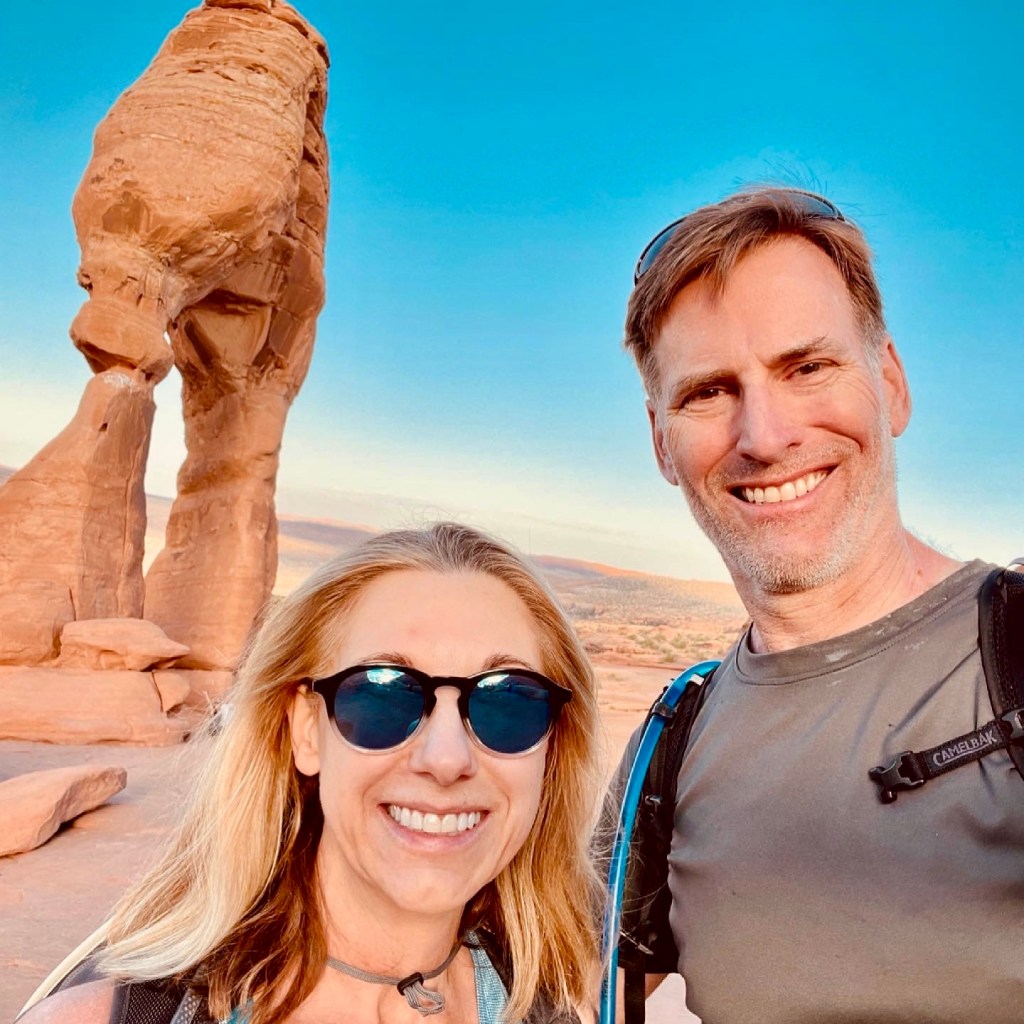

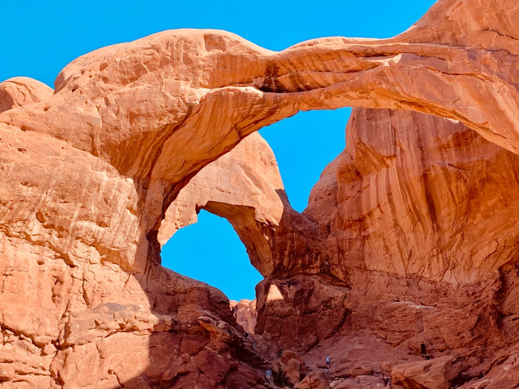
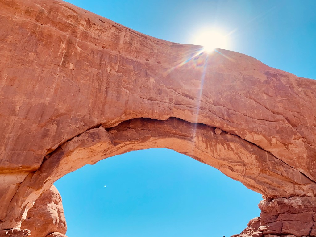

There’s some cool Ute rock art near the beginning of the hike to Delicate Arch. Then we drove to Double Arch (just stunning!) where we parked once and saw a lot. We spent some time under the connected arches and then walked across the big parking lot where we hiked a primitive trail to see the North and South Windows and Turret Arch. Don’t miss Landscape Arch, the longest arch in the world; this hike is 2 to 7.2 miles, depending upon how you do it). We started at 5:45 a.m. and spent an entire day at Arches.
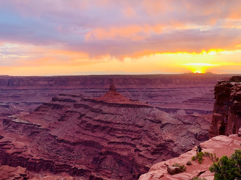
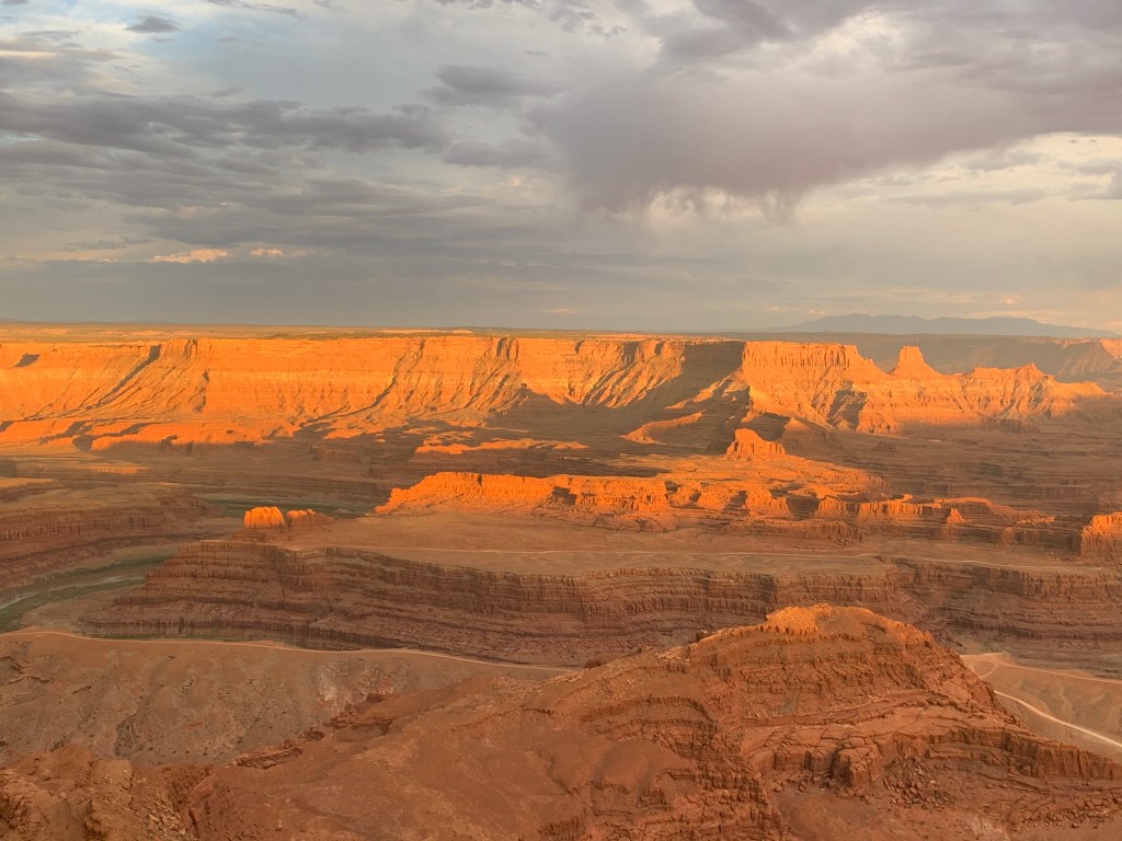
Dead Horse Point State Park is near Canyonlands and is especially pretty at sunset. Go early (before tour buses arrive) and get a spot on the terrace just below the lookout point so you’ll not have other people’s heads in your photos. Then look to the rocks as the setting sun makes them glow with vibrant reds and oranges and pinks. The Colorado River snakes through the canyon 2,000 feet below. It’s a magical way to end the day. This park, a Dark Sky Park, sometimes has ranger-led stargazing events.


Where to Stay:
We rented a VRBO condo on a quiet side street near the busy downtown area of Moab (with lots of off-road vehicles on the road, it’s kind of like a scene from Mad Max). Our little unit was beautifully decorated, (loved the nice linens and custom sinks!) ideally located (out of the fray) and perfect for two. Our host, Kimberley, offered an informative, insider’s guide to the area and helped us make the most of our time in Moab.
What to Eat:

Get street tacos and elote at Giliberto’s Mexican Taco Shop in Moab (there’s a drive-thru) and go to Dead Horse Point for a sunset picnic; for a fancy dinner go to Desert Bistro (reservations required); Moab Brewery has burgers and nachos, and Johnny’s American IPA, Juicy Johnny’s Hazy IPA and the Dead Horse Amber Ale all are delicious.
Don’t Miss:
Sunrise at Mesa Arch in Canyonlands, sunrise or sunset at Delicate Arch in Arches, sunset at Dead Horse Point, stargazing at any of these International Dark Sky Parks

On the way to Capitol Reef National Park, we stopped off at Little Wild Horse Canyon near Goblin Valley State Park. Little Wild Horse is a fun slot canyon that’s suitable for just about anyone (including kids). There’s a trailhead (with a toilet and a good map), and the slot is easy to find. It’s narrow enough to know you are in a slot, but it’s not so narrow that it’s uncomfortable. And the colors are amazing!

It widens into a larger canyon and you can continue to a longer loop or turn around and come back the way you came. Plan to spend 2-3 hours here. NOTE: Slot canyons are off-limits if there has been recent rain or if there is a chance of rain anywhere nearby; they are prone to deadly flash flooding.

We also visited Goblin Valley State Park, and although its hoodoos, like the iconic Three Sisters above, are significant and impressive, we didn’t stay long. The trails are not well marked at all; there were several frustrating moments when the trails just seemed to disappear. The one we did manage to stay on was like hiking through a sandcastle, and hiking through a sandcastle is not that much fun.
Torrey—Capitol Reef National Park with a side trip through Grand Staircase-Escalante National Monument


You can see much of beautiful Capitol Reef simply driving through it, but this park with its cliffs, canyons, domes and natural bridges in the Waterpocket Fold (a wrinkle on the earth extending almost 100 miles), is a hidden gem. An 8-mile scenic drive features breathtaking views, and there are 15 day-hiking trails here. Make sure to stop at the petroglyphs just off the main road near the visitor station. We did a moderate, 2-mile out-and-back hike to Hickman Bridge to get a feel for this lesser-known park, and we saw a golden eagle here.

You’ll want to be at Capitol Reef for sunset; it’s amazing. Then come back to anywhere in this International Dark Sky Park for some of the best stargazing you will ever experience. You can easily see this park in one day or even a half day.
Where to Stay:
Red Sands Hotel and Spa in Torrey
What to Eat:
Wingstrands for farm-fresh food; we got takeout to eat during sunset
Don’t Miss:
Sunset at Sunset Point, stargazing anywhere in the park, the petroglyphs just east of the visitor center
Highway 12 and Grand Staircase-Escalante National Monument
Take the amazing, winding Scenic Byway 12 (UT-12) or just “Highway 12” to get from Torrey to Bryce Canyon. This All-American Road is more than 122 miles long, and it’s one of the most beautiful drives in the country. You travel through a diverse and beautiful and rugged landscape of arches, mountains, slickrock canyons, red rock cliffs, aspen and pine forests, mountain meadows, national parks, state parks, a national monument and quaint rural towns.
Part of Highway 12 crosses various parts of Grand Staircase-Escalante National Monument, which covers nearly 1 million acres of public lands. There are three distinct units here: Grand Staircase, Kaiparowits and Escalante Canyon. It’s so remote and rugged that it was one of the last places in the continental United States to be mapped! We went there looking for a few specific slot canyons and we found them down Hole-in-the-Rock Road (BLM Road 200).

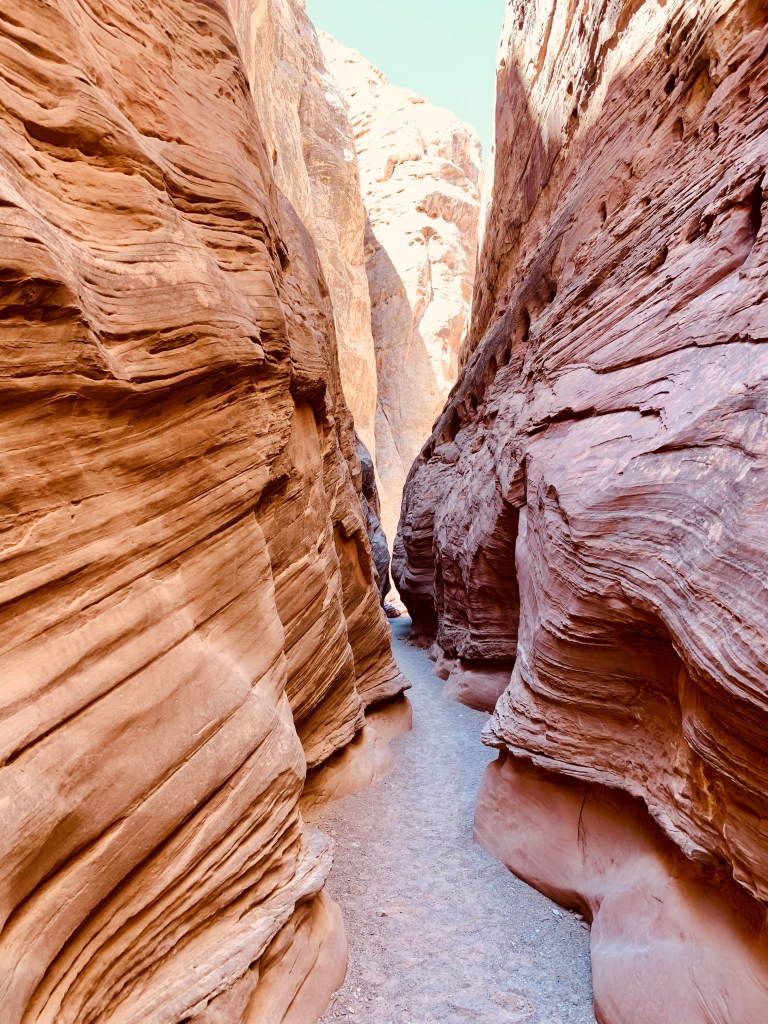
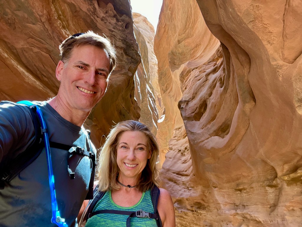
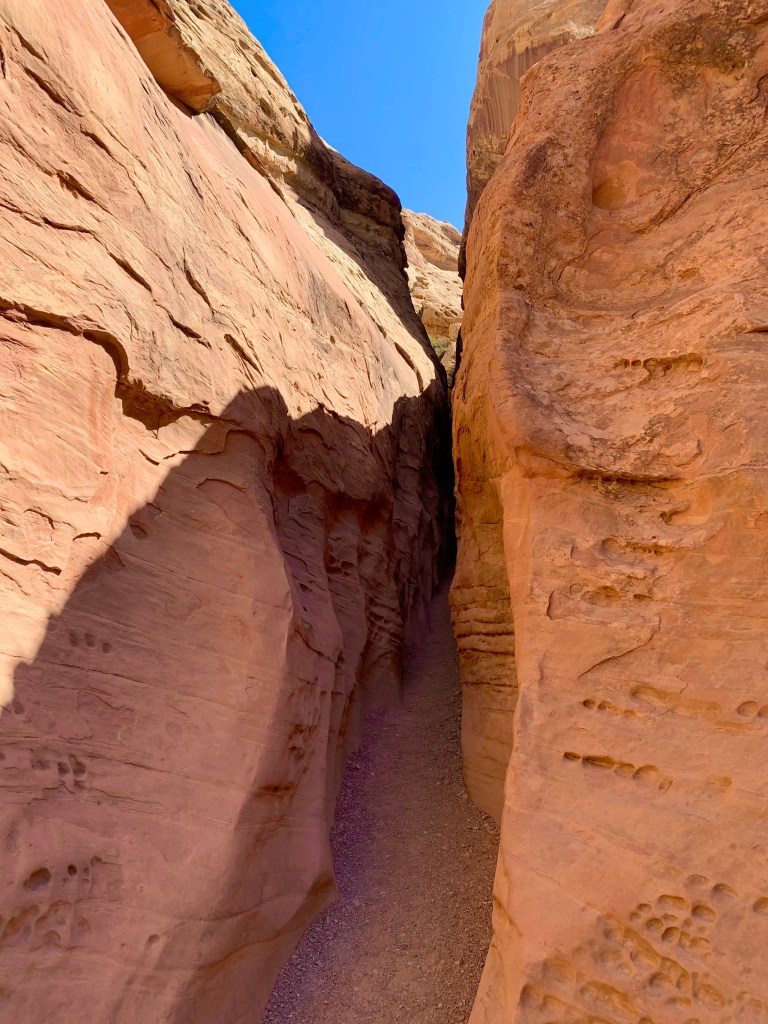
If you are adventurous and in fairly good shape with a relatively small frame and not claustrophobic(!), visit Dry Fork Narrows and Peek-a-Boo and Spooky Gulch slot canyons in Grand Staircase-Escalante. This is a true adventure! The slots are down 26 miles of dirt road, but you can rent a Jeep in Escalante that can handle the trip.
Once at the trailhead, just getting to the slot canyons requires a two-mile hike along the rim and down some short cliffs and across desert dunes following well-spaced trail markers called cairns. Next time, we’ll take the Upper Dry Fork trail 1.5 miles through Dry Fork Narrows. But Peek-a-Boo and Spooky, with their tight and twisty, beautiful and wavy, red and purple walls, are your ultimate goals, and they are worth any trouble. (They require almost zero technical skill or know-how other than some rock-scrambling skills.)

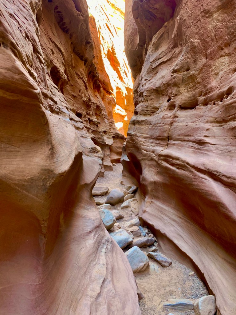
Peek-a-Boo is a tight slot that corkscrews back on itself. Your photos will be fantastic! The hardest part was just getting into this slot; you climb about 10 (challenging) feet up a dry fall to the entrance using shallow hand and foot holds (go at it sideways and chimney up by bracing with your back and your legs or have your strong hiking partner haul you up). After that, it’s just awesome in the truest sense of that word, as you twist and turn through what feels like an adult playground. At the end of Peek-a-Boo, you’ll hike across about a half mile of desert to get to Spooky, which is an even tighter slot that narrows to about a foot wide in spots.
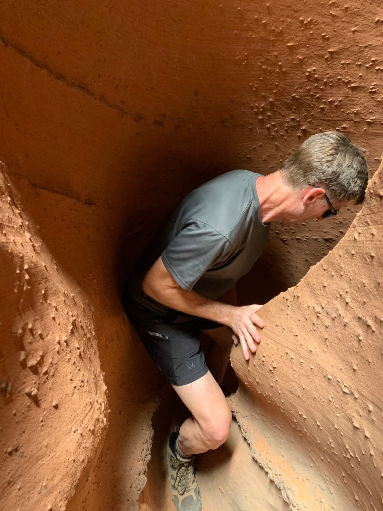
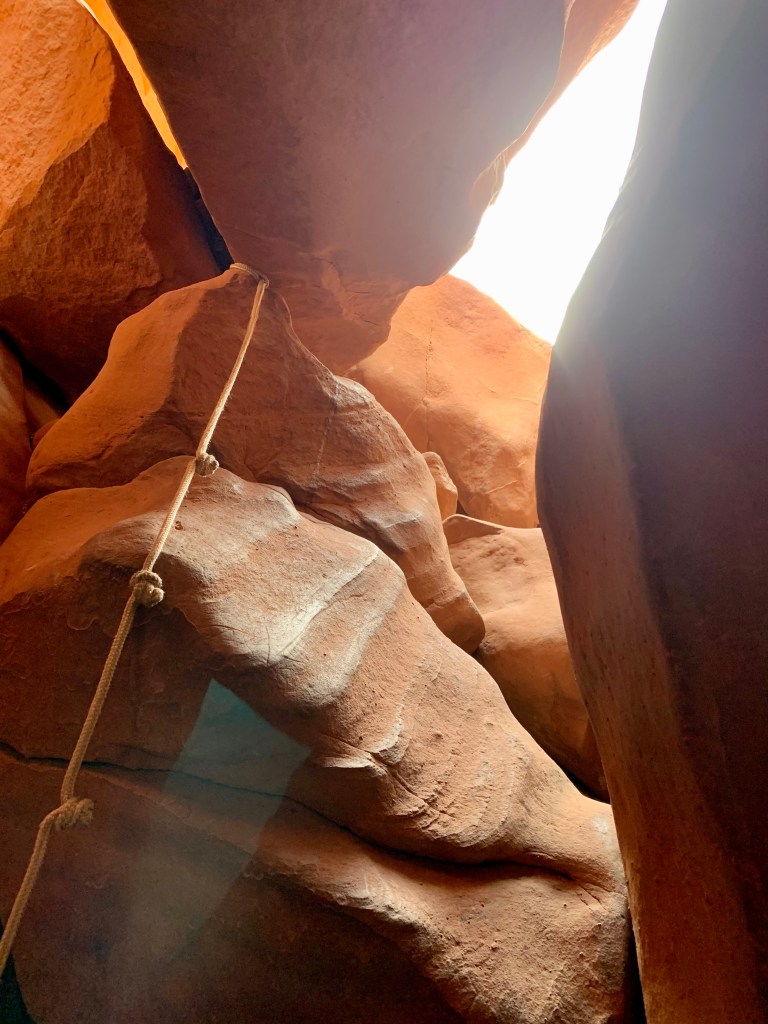


People with smaller builds do better here … just saying. If you take your backpack, you’ll need to take it off and carry it above your head at times. There are some tricky parts where you must work out how to navigate around boulders or short descents (wear clothes you don’t care about; they might get torn) and there’s a knotted rope you’ll use to get past a 6-foot drop. Other than that, it’s just thrillingly narrow and very beautiful. We spent about 4 (truly delightful) hours here. We hiked about 6 miles total.
Here’s a link that tells you how to find these slots. For current conditions on any of the slot canyons off Hole-in-the-Rock Road, Burr Trail, or other hiking opportunities in, or along the Escalante River and its side canyons, contact the Escalante Interagency Visitor Center at 435-826-5499.
Tropic—Bryce Canyon National Park
This was my bucket-list location—really the reason I wanted to head West in the first place—and it was more spectacular than I ever imagined! There is nothing on earth quite like Bryce Canyon with its many thousands of colorful and ancient hoodoos and cliffs that range from white to pink to orange to deep red. Fun fact: Hoodoos (irregular columns of rock) exist on every continent, but Bryce has the largest concentration found anywhere on Earth.
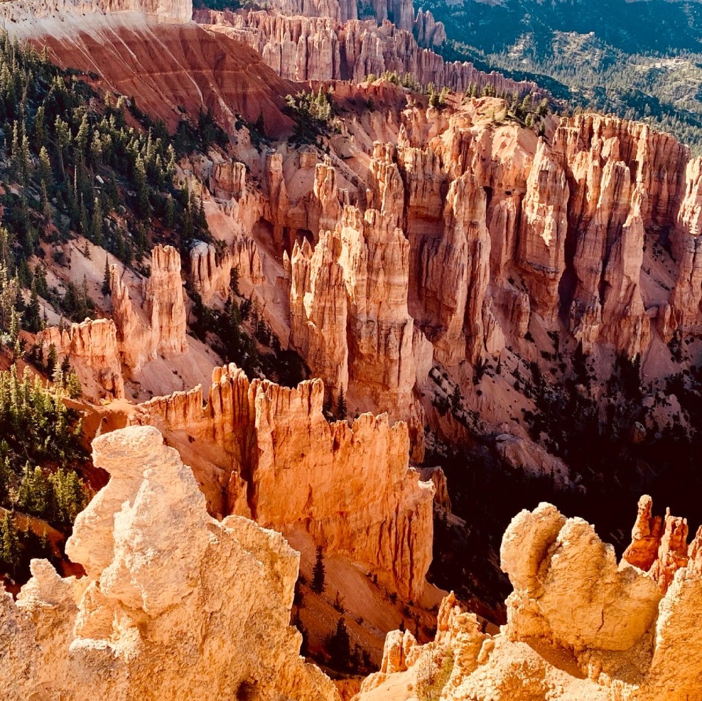
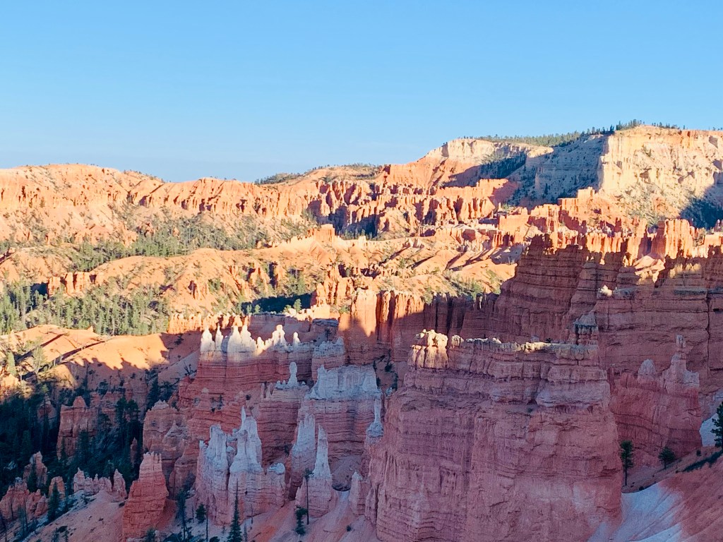
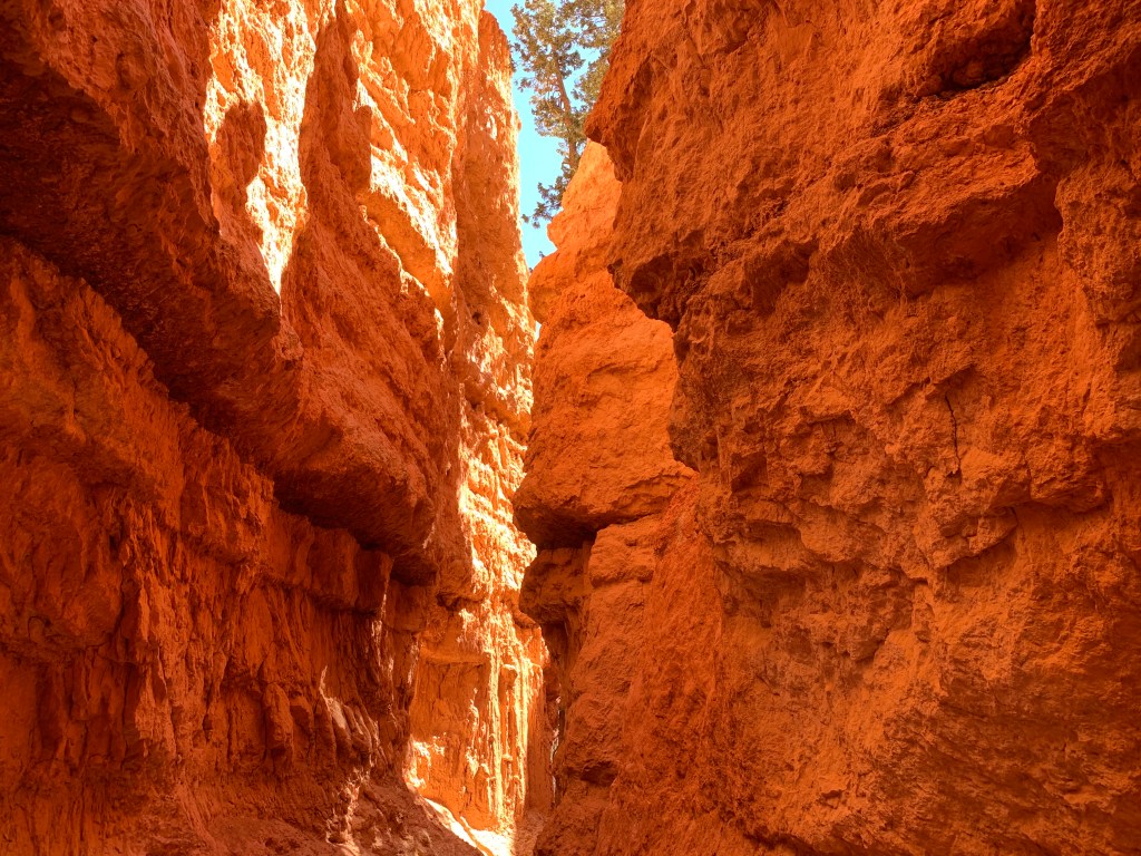


We did the 8-mile Fairyland Loop (more than 1,700 feet of elevation change) that offers views you simply cannot get otherwise. There’s some climbing along uneven trails; boots are best. You’ll hike to the bottom of the amphitheater and then up again on the far side of the park above another valley of younger hoodoos. Go early in the day or late in the afternoon; the colors are best early and late. We also hiked the Queen’s Garden/Navajo Loop (clockwise) and came up Wall Street, which is a short, yet awesome, slot canyon with terraced steps leading out of it at the end. So impressive! (It’s closed during the winter months.) We spent an entire long day at Bryce and logged 14 miles of hiking. I’d recommend at least a day, maybe two.
Where to Stay:
We stayed in a little log cabin at Bryce Canyon Inn in Tropic (this is about 10 miles outside the park). You can stay in Bryce Canyon City just outside the park or, with luck and advance planning, at The Lodge at Bryce Canyon (reservations are limited).
What to Eat:
Rustler’s Restaurant in Tropic kept us nicely fed for two days straight and didn’t mind that we ran in about 30 minutes before closing both days. There’s a fantastic coffee shop—Bryce Canyon Coffee Company—at the Bryce Canyon Inn with great espresso drinks and fresh pastries.
Don’t Miss:
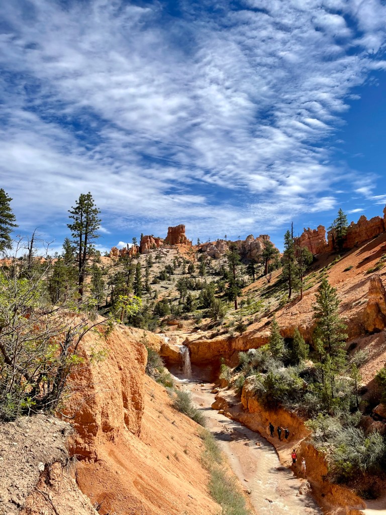
Anywhere you look in Bryce is absolutely beautiful. Stop off at Fairyland Point near the park entrance when you first arrive for a preview of what’s to come. Do the full Fairyland Loop if you are up for an 8-mile hike (We did this counter-clockwise and took our time, and the entire hike with lots of picture taking took us about 5.5 hours); Queen’s Garden/Navajo Loop trail (do this 3-mile loop clockwise so you come up Wall Street slot canyon), sunset at Sunset Point, the short Mossy Cave hike just outside the park proper, the scenic drive to Rainbow Point, which at 9,115 feet is one of highest points in the park. (Drive up and then stop at the overlooks on the way down to avoid cross traffic.) Make time for stargazing at this International Dark Sky Park. With the right timing and some luck, you can enter a lottery to go on a Full Moon Hike.
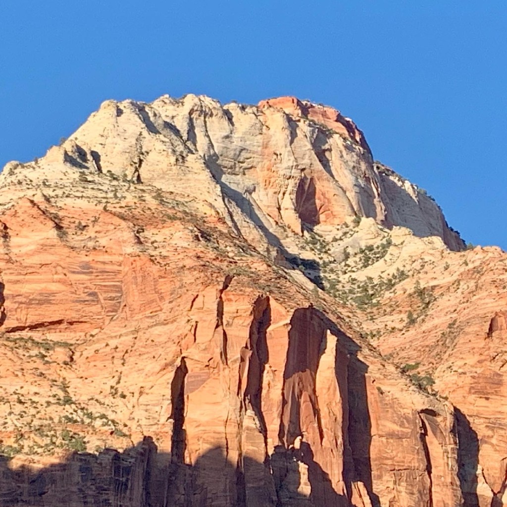
St. George—Zion National Park and Anasazi Valley Petroglyph Trail (Tempi’po’op) and Snow Canyon State Park
First of all, Zion is a zoo right now. Especially this summer when all of America wants to go somewhere and lots of them decided Zion is that place. Several of the popular trails were closed when we visited because of a big rockfall, so that meant even more people on the ones that were open. We could only access these trails inside the park via shuttle service, and that meant long lines and overcrowded shuttles. (The park opens the Scenic Drive to private vehicles January to mid-February only.) And unless you have good parking karma, you’ll need to take a different shuttle service in the town of Springdale just to get to the park entrance. (Also, the town shuttle stops running before the park shuttle ends, so plan accordingly.)


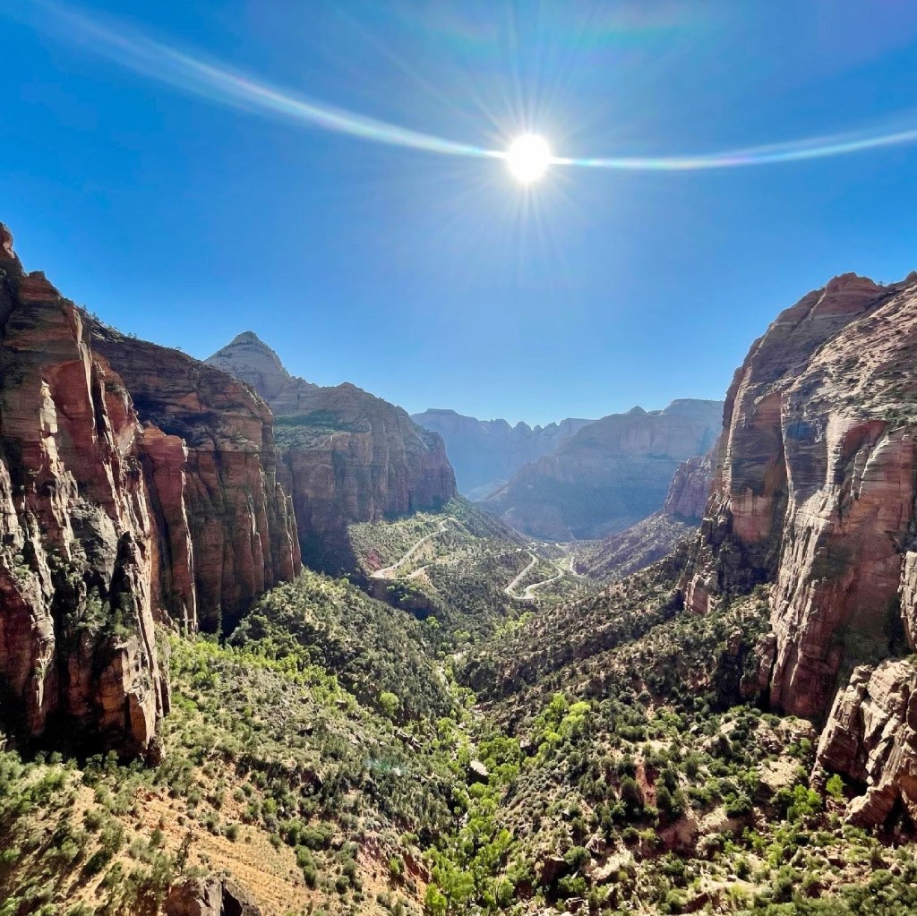
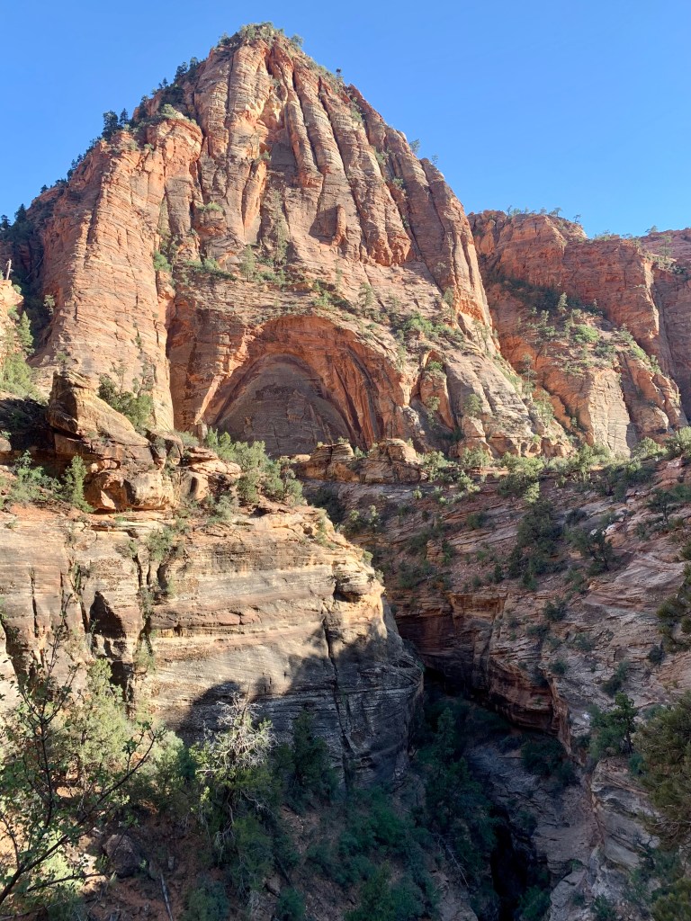

When we hiked The Narrows, there were always at least 50 people right around us; there were probably 500 on the watery trail that morning; it felt like walking out of a college football game – except mostly in knee-deep water. We skipped Angels Landing and opted for the less-traveled Canyon Overlook Trail, which was wonderful. This is the only trail within the park you can drive to via the Scenic Drive (which includes a mile-long tunnel), but parking is very, very limited; we went late in the day. The drive is awesome with lots of pullouts for photos of the monumental mountains and cliffs and a that long, scary tunnel through the mountain and we saw a family of bighorn sheep on the mountainside.
Even with the crowds, this park is breathtakingly beautiful. Just the the scale of it all! I understand why it’s so popular.
NOTE: If you hike The Narrows, rent some water shoes and a thick hiking stick from Zion Outfitter in Springdale just outside the pedestrian entry to Zion. You can do this online and pick up your gear the night before (after 4) or walk up after 4 the day before your hike to rent them or even walk up the morning you arrive if you’re not a planner. You’re welcome!
We skipped a second day at Zion in favor of some less-crowded destinations. Anasazi Valley Petroglyph Trail (Tempi’po’op), pronounced: tumpee poo oop, in Santa Clara was a great way to spend a few hours. This family-friendly hike winds through through the desert, past the ruins of an Anasazi farmstead (built about 1,000 years ago) to the top of a hill where we climbed amongst a tumble of boulders to see (up close!!) some incredibly well-preserved ancient petroglyphs.


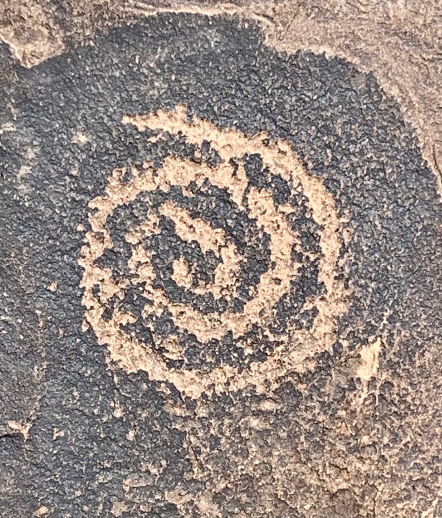
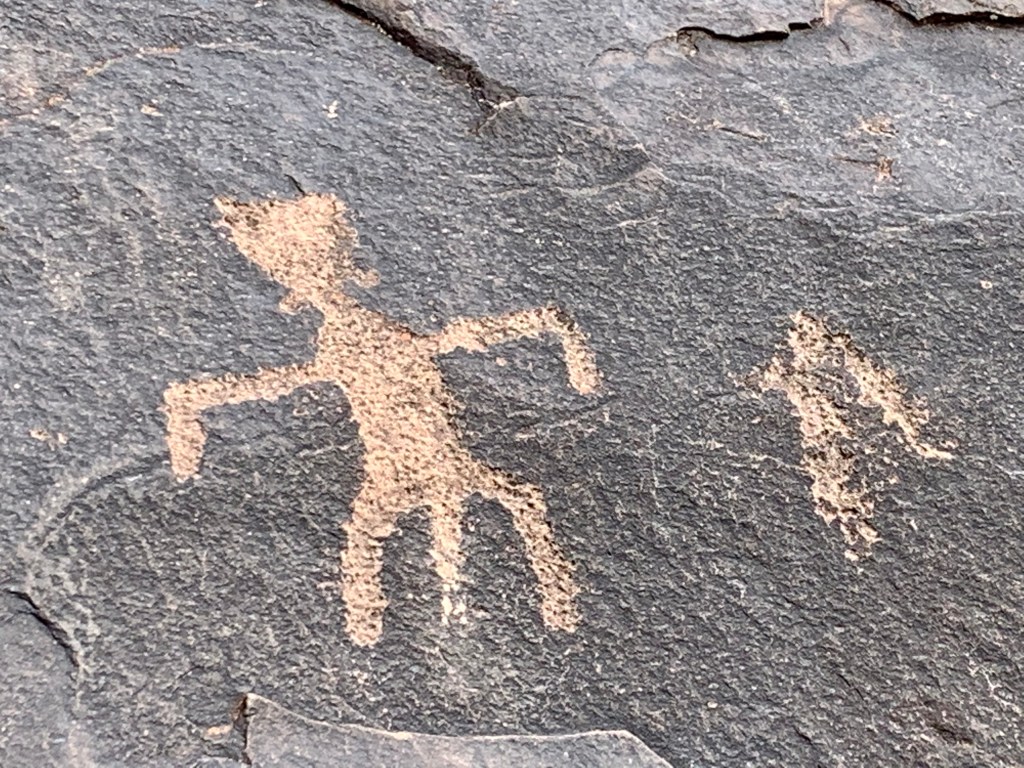
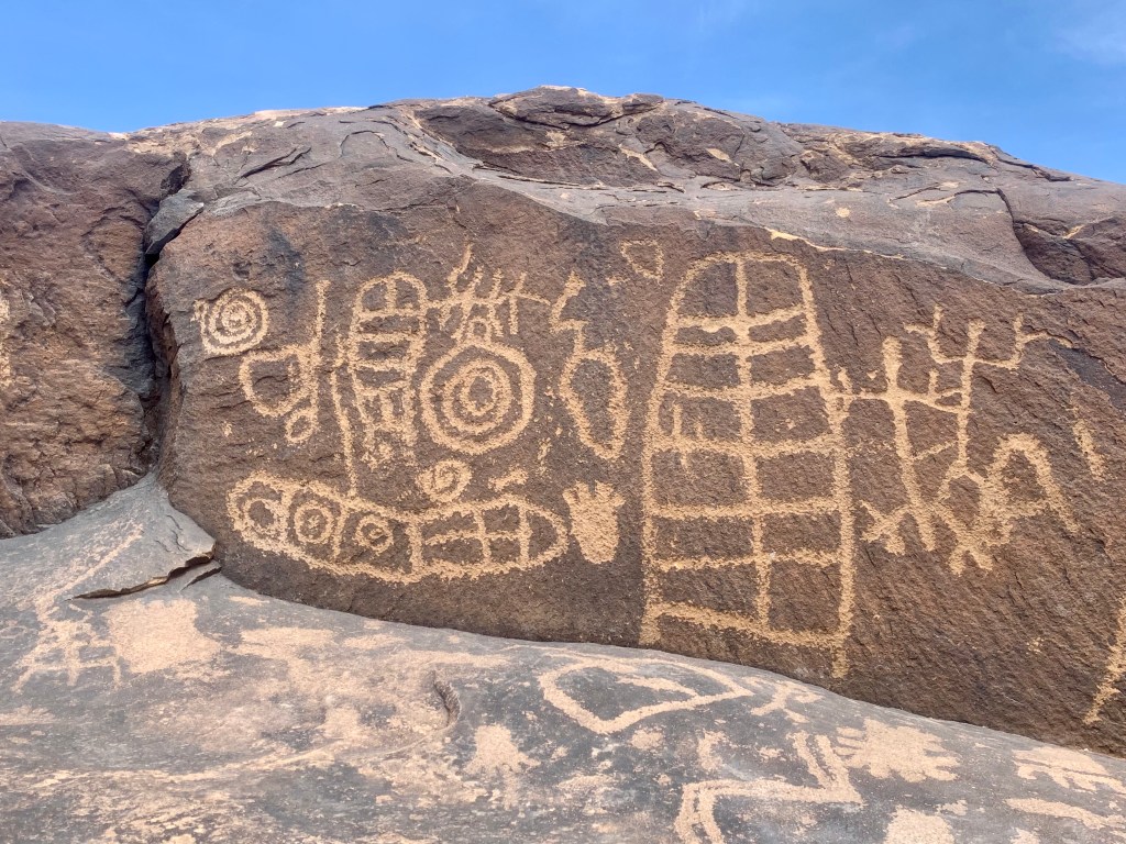
These were carved into the desert varnish on the rocks by Ancestral Puebloans. Lots of the art—from small bear claw images to snakes to bighorn sheep and geometric shapes—is quite accessible without bouldering; you can just walk along the rim trail and see plenty, but climb down to find them everywhere! We spent about 2 hours on this 3.5-mile out and back.
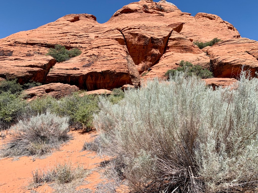
Snow Canyon State Park is awesome! We spent most of the day (with a break for lunch) at this colorful park with its red petrified dunes and red and white Navajo sandstone cliffs and black lava flows. The park is located in the 62,000-acre Red Cliffs Desert Reserve, established to protect the federally listed desert tortoise and its habitat.


The trails are well-marked with signs and cairns, and you’ll line up a series of shiny silver metal markers attached to the dunes to navigate those huge formations. So smart!
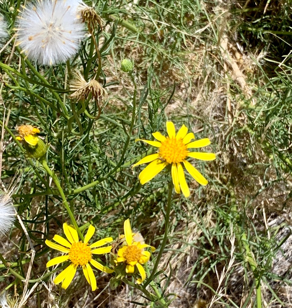
There’s a short slot canyon here, and you can climb into lava tubes from an extinct volcano. The landscape at Snow Canyon is so interesting, and a hike though the sagebrush-scented desert dotted with wildflowers and surrounded by soaring red cliffs is lovely in so many ways. There were times, we were the only hikers as far as we could see.
Where to Stay:
It’s more convenient to stay in Springdale just outside Zion or at Zion Lodge inside Zion if this park is your main/only destination But if you want to explore more of this part of southern Utah, Washington/St. George would be a good central location. We stayed at the Holiday Inn Express in Washington.
What to Eat:
We had our first In-N-Out Burger in Washington, and we loved Mixed Greens in a Chevron station in Santa Clara. There’s every kind of food you could want in the town of Springdale outside Zion.
Don’t Miss:
At Zion, The Narrows and Angels Landing are the iconic hikes; the Canyon Overlook Trail is less traveled than Angels Landing and offers spectacular long views. Make sure to rent those water shoes if you do The Narrows. And take time for the Scenic Drive at Zion. Venture down into the fallen boulders at Anasazi Valley Petroglyph Trail. At Snow Canyon, walk through Jenny’s Canyon (the slot canyon) and hike those petrified dunes. Do seek out a lava tube or two and climb in, because why not?
North Rim of Grand Canyon National Park
The North Rim of the Grand Canyon was closer and less crowded (only 10% of Grand Canyon visitors go here) and the views are still spectacular. We spent a day here, starting with the short walk to Bright Angel Point and doing a 4-mile round-trip hike along the partially shaded Transept Trail, which winds up and down along the canyon rim and through the forest. We drove up to Point Imperial, which at 8,803 feet is the highest point in the park.


We were lucky to be at the Grand Canyon for a star party. A star party! It was actually held at the Kaibab Lodge outside the park. Three amateur astronomers set up huge telescopes (20- and 22-inch mirrors) and we just rotated from one to the other in the pitch-black dark looking at deep-space objects like globular star clusters and distant galaxies. Our own Milky Way stretched all the way across the sky and the occasional meteor kept us entertained along with a small band (2 or 3 or 4 people; hard to say—it was dark) playing mysterious desert music/sounds. So. Much. Fun. Check with each park for night-sky programs.
Where to Stay:
Kaibab Lodge is just outside the park and we stayed in a small cabin. There’s lots of lodging inside the park, including cabins and the beautiful Grand Canyon Lodge, but reservations are somewhat hard to get; there’s a booking schedule; start planning now.)
Where to Eat:
There’s a lovely restaurant at the park Lodge, you’ll also find a deli, coffee shop and a saloon with cocktails and lots of local beer. Kaibab Lodge offered a buffet of homestyle foods, and we especially loved the wings that they smoke for hours. Go across the street to the convenience store to get beer or wine and bring it with you to dinner.
Don’t Miss:
Just sitting in an Adirondack chair on the Grand Canyon Lodge verandah with a local brew and enjoying the views, the Transept Trail, the amazingly dark skies (with or without an actual star party), animal sightings (the bison are right on the side of the road)
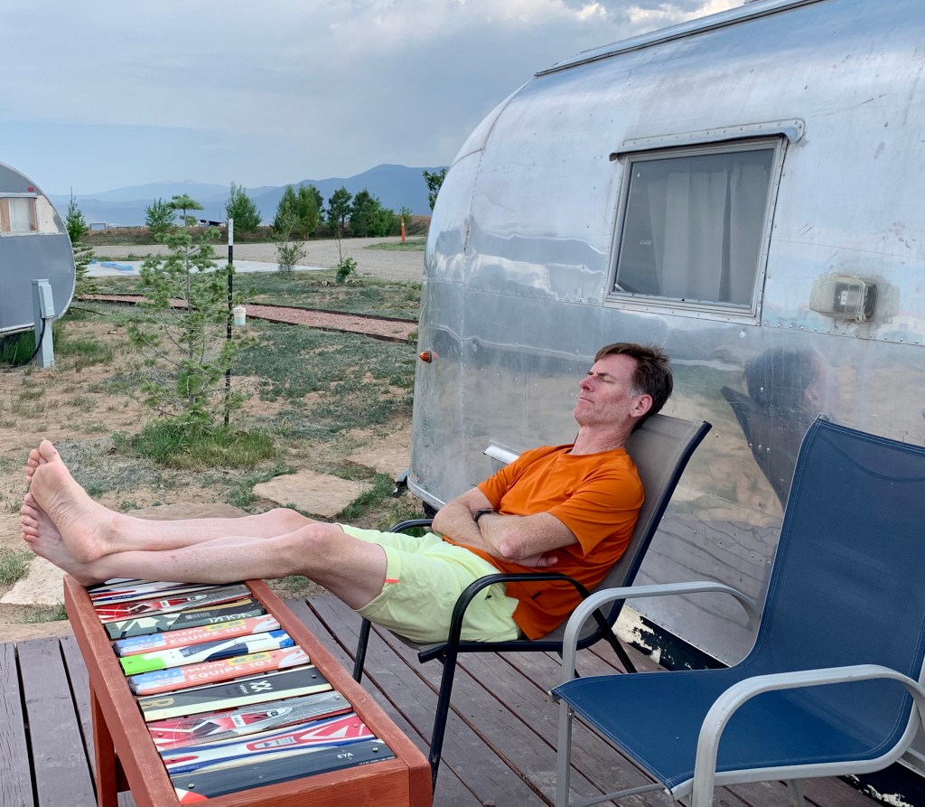
One final thing: We ended our adventure at Hotel Luna Mystica, a vintage Airstream trailer hotel and starlight campground in Taos, New Mexico. We stayed in a cozy 1962 Airstream named Ralphie. All the trailers have their own fire pits and porches. It was the perfect way to finish our two-week trip of a lifetime.


Before you go:
- Create an account at recreation.gov so you can reserve lodging and campsites, buy passes and gain access to ticketed events.
- If possible, stay in the park where sunrises and sunsets and starry skies are just steps away.
- Follow the parks you’ll be visiting on Instagram for updates and news.
- Buy a US Park Pass. It’s $80 and provides free entry to all National Parks and other federal recreational lands for a year and allows you to bring three other adults. (Children under 16 are always free.) If you’re going to see more than two parks, it’s likely it will pay for itself.
- Download the NPS app and find the parks you’ll visit. You can download your favorites to access offline (that’s important, as cell service is spotty at best!).
- Make sure you get the park’s “newspaper” in addition to the glossy guide when you enter (or go to the visitor center and get it when they open if you enter before the gate is staffed; the national parks are open 24 hours a day). The newspaper is your key to the best experience, allowing you to make the most of your time there. You also can access this newspaper for some of the parks on the NPS app.
- Most of these are certified International Dark Sky Parks; plan your visit around a new moon if you like stargazing (sometimes there are ranger-led programs with telescopes) or go during a full moon for ranger-led night hikes (if possible, register ahead of time for these at recreation.gov).
- Load up on sunscreen and water. Always have a gallon of water in your car.
- Hiking boots are best (especially in Bryce); mid height is fine. In any case, make sure you have shoes with excellent traction; Utah is covered in what they call “slickrock” that’s often sandy, too. For some of the ranger-led programs, you have to actually show that you have proper shoes.
- Hiking poles made many of these trails easier. I used Black Diamond Distance Z Trekking poles
- I carried an Osprey Daylite backpack with a 1.5 liter water reservoir nearly all the time.

this is absolutely fabulous!!!!!
LikeLike
Thank you Blaire! I hear you had your own adventures!
LikeLike
Not only were the pictures beautiful but the article was full of wonderful, useful information.
FYI: You can easily fly into and out of Phoenix and rent a car there for a wonderful trip. Also, Mesa Verde in sw Colorado is worth the drive.
LikeLike
Thank you Bruce, for your kind words and awesome suggestion! We plan to go back! Safe travels to you!
LikeLike